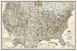
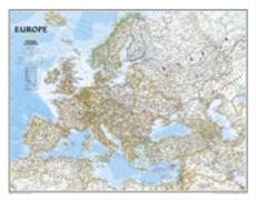
Our classic political map of Europe features country boundaries, place names, bodies of water, airports, major highways and roads, and much more. Map is printed on premium quality paper stock, rolled, and packaged in a clear, hard plastic tube."Map Scale = 1:8, 425, 000Sheet Size = 30.25" x 23.75
- Waterproof - Tear-Resistant - Topographic MapExplore the wonders of the Bob Marshall Wilderness Complex with National Geographic's Bob Marshall Wilderness Trails Illustrated Map. This area includes four national forests and the Great Bear, Bob Marshall, and Scapegoat Wilderness Areas. Encompassing the highest concentration of grizzlies in the continental U.S., this region extends from Seeley Lake in the South to the northern tip of Hungry Ho...
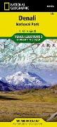
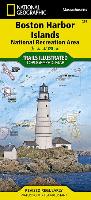
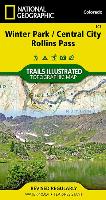
National Geographic's Trails Illustrated Maps are the most detailed and up-to-date topographic recreation maps available for US National Parks, National Forests and other popular outdoor recreation areas. A necessity for exploring the outdoors, each map is printed on waterproof, tear-resistant material. They also contain key safety and contact information, GPS and compass coordinates, Leave No Trace ethical guidelines and hundreds of points-of...
- Waterproof - Tear-Resistant - Topographic MapThis map covers the Pine Valley Ranger District of Dixie National Forest, a high-elevation mountain sanctuary from the hot, southern Utah desert that surrounds it. Coverage extends from the Kolob Canyons area of Zion National Park in the northeast to Saint George, Utah to the south, and the Nevada state line to the west. Key features are the Pine Valley Recreation Area, ideal for hiking, horseback...
- Waterproof - Tear-Resistant - Topographic MapsIn a state known for its trails, The Colorado Trail is Colorado's premier long distance trail. Conceived in 1973 and completed in 1987, the trail runs 486 miles between Denver and Durango, traversing some of the most spectacular scenery in the state. This Map Pack combines the entire standard route into a single easy to purchase product. The Colorado Trail Map Pack includes: Map 1201:: Colorado T...
- Waterproof - Tear-Resistant - Topographic MapsBanff is Canada's first and most visited national park. Banff is one of the world's premiere destinations, spanning a region of unparalleled majestic mountain scenery. This Map Pack combines two maps that cover Banff, Yoho and Kootenay National Parks. All three national parks cover one of the most rugged areas in North America with mountain glaciers and breathtaking lakes.The Banff National Park ...
- Waterproof - Tear-Resistant - Topographic MapsColorado has the highest mean elevation of any state in the United States. It's home to 58 mountain peaks higher than 14, 000 feet--more than any other state in the U.S--making it a mountain sports mecca. "Bagging" these fourteeners is a goal for many Coloradans and visitors to the state--and for some, it's an obsession.Each map page provides accurate trail statistics including trail mileages, to...
- Waterproof - Tear-Resistant - Topographic MapsCanyonlands National Park encloses 337, 598 acres of colorful canyons, mesas, buttes, fins, arches, and spires in the heart of southeast Utah's high desert. This Map Pack combines the three distinct districts of Canyonlands into an easy to purchase bundle. While the districts appear close on a map, there are no roads that directly link them so each map in the bundle represents a different adventu...
- Waterproof - Tear-Resistant - Topographic MapsThe South Platte River map pack covers 142 miles of the South Platte river from the headwaters above Alma on the Middle Fork nearly to the Denver suburbs at Chatfield Reservoir. The upper reaches of the South Platte meander through open ranch land interspersed with Wildlife Management Areas and large reservoirs. Some of the best trout fishing in Colorado can be found in this slow moving section o...
- Waterproof - Tear-Resistant - Fishing & River MapThe Arkansas River map pack bundle covers 123 miles of the Arkansas from the slowly meandering stream above Leadville to the raging river that passes through the Royal Gorge above Cañon City. On its journey the river passes through some of the most heavily run whitewater in the country with nearly inaccessible gorges and rapids with names like 'Raft Ripper' and 'Widowmaker'. The river also pas...
National Geographic's Trails Illustrated Maps are the most detailed and up-to-date topographic recreation maps available for US National Parks, National Forests and other popular outdoor recreation areas. A necessity for exploring the outdoors, each map is printed on waterproof, tear-resistant material. They also contain key safety and contact information, GPS and compass coordinates, Leave No Trace ethical guidelines and hundreds of points-of...
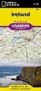
AdventureMaps provide global travellers with the perfect combination of detail and perspective, highlighting hundreds of points of interest and the diverse and unique destinations within the country. Each map is printed on durable synthetic paper, making them waterproof and tear-resistant. They also include the locations of cities and towns with a user-friendly index, plus a clearly marked road network complete with distances and designations ...
National Geographic's Trails Illustrated Maps are the most detailed and up-to-date topographic recreation maps available for US National Parks, National Forests and other popular outdoor recreation areas. A necessity for exploring the outdoors, each map is printed on waterproof, tear-resistant material. They also contain key safety and contact information, GPS and compass coordinates, Leave No Trace ethical guidelines and hundreds of points-of...
National Geographic's Trails Illustrated Maps are the most detailed and up-to-date topographic recreation maps available for US National Parks, National Forests and other popular outdoor recreation areas. A necessity for exploring the outdoors, each map is printed on waterproof, tear-resistant material. They also contain key safety and contact information, GPS and compass coordinates, Leave No Trace ethical guidelines and hundreds of points-of...
National Geographic's Trails Illustrated Maps are the most detailed and up-to-date topographic recreation maps available for US National Parks, National Forests and other popular outdoor recreation areas. A necessity for exploring the outdoors, each map is printed on waterproof, tear-resistant material. They also contain key safety and contact information, GPS and compass coordinates, Leave No Trace ethical guidelines and hundreds of points-of...
National Geographic's Trails Illustrated Maps are the most detailed and up-to-date topographic recreation maps available for US National Parks, National Forests and other popular outdoor recreation areas. A necessity for exploring the outdoors, each map is printed on waterproof, tear-resistant material. They also contain key safety and contact information, GPS and compass coordinates, Leave No Trace ethical guidelines and hundreds of points-of...
Coverage includes BLM/San Juan Resource Area, Grand Gulch Primitive Area, Grand Flat, Northern Glen Canyon National Recreation Area, Valley of the Gods, Cedar Mesa, Snow Flat, Grand Flat and Comb Ridge, First, Fish and Owl Creek, Polly Mesa and San Juan River. Includes UTM tick marks for use with your GPS unit.


![Colorado Trail [Map Pack Bundle]](https://support.digitalhusky.com/media/annotations/sorted/246/24655144/CHSBZCOP0324655144.jpg)
![Banff National Park [Map Pack Bundle]](https://support.digitalhusky.com/media/annotations/sorted/246/24655142/CHSBZCOP0324655142.jpg)
![Colorado 14ers [Map Pack Bundle]](https://support.digitalhusky.com/media/annotations/sorted/246/24655149/CHSBZCOP0324655149.jpg)
![Canyonlands National Park [Map Pack Bundle]](https://support.digitalhusky.com/media/annotations/sorted/246/24655141/CHSBZCOP0324655141.jpg)
![South Platte River [Map Pack Bundle]](https://support.digitalhusky.com/media/annotations/sorted/246/24655139/CHSBZCOP0324655139.jpg)
![Arkansas River [Map Pack Bundle]](https://support.digitalhusky.com/media/annotations/sorted/246/24655137/CHSBZCOP0324655137.jpg)
![Nantahala and Cullasaja Gorges Map [Nantahala National Forest]](https://support.digitalhusky.com/media/annotations/sorted/107/10754874/CHSBZCOP0310754874.jpg)
![Alpine Lakes Wilderness Map [Mt. Baker-Snoqualmie and Okanogan-Wenatchee National Forests]](https://support.digitalhusky.com/media/annotations/sorted/107/10754902/CHSBZCOP0310754902.jpg)
![Superstition and Four Peaks Wilderness Areas Map [Tonto National Forest]](https://support.digitalhusky.com/media/annotations/sorted/107/10754894/CHSBZCOP0310754894.jpg)
![Goat Rocks, Norse Peak and William O. Douglas Wilderness Areas Map [Gifford Pinchot, Mt. Baker-Snoqualmie, and Okanogan-Wenatchee National Forests]](https://support.digitalhusky.com/media/annotations/sorted/107/10754900/CHSBZCOP0310754900.jpg)
![Grand Gulch, Cedar Mesa Plateau Map [Blm - Monticello Field Office]](https://support.digitalhusky.com/media/annotations/sorted/107/10754872/CHSBZCOP0310754872.jpg)